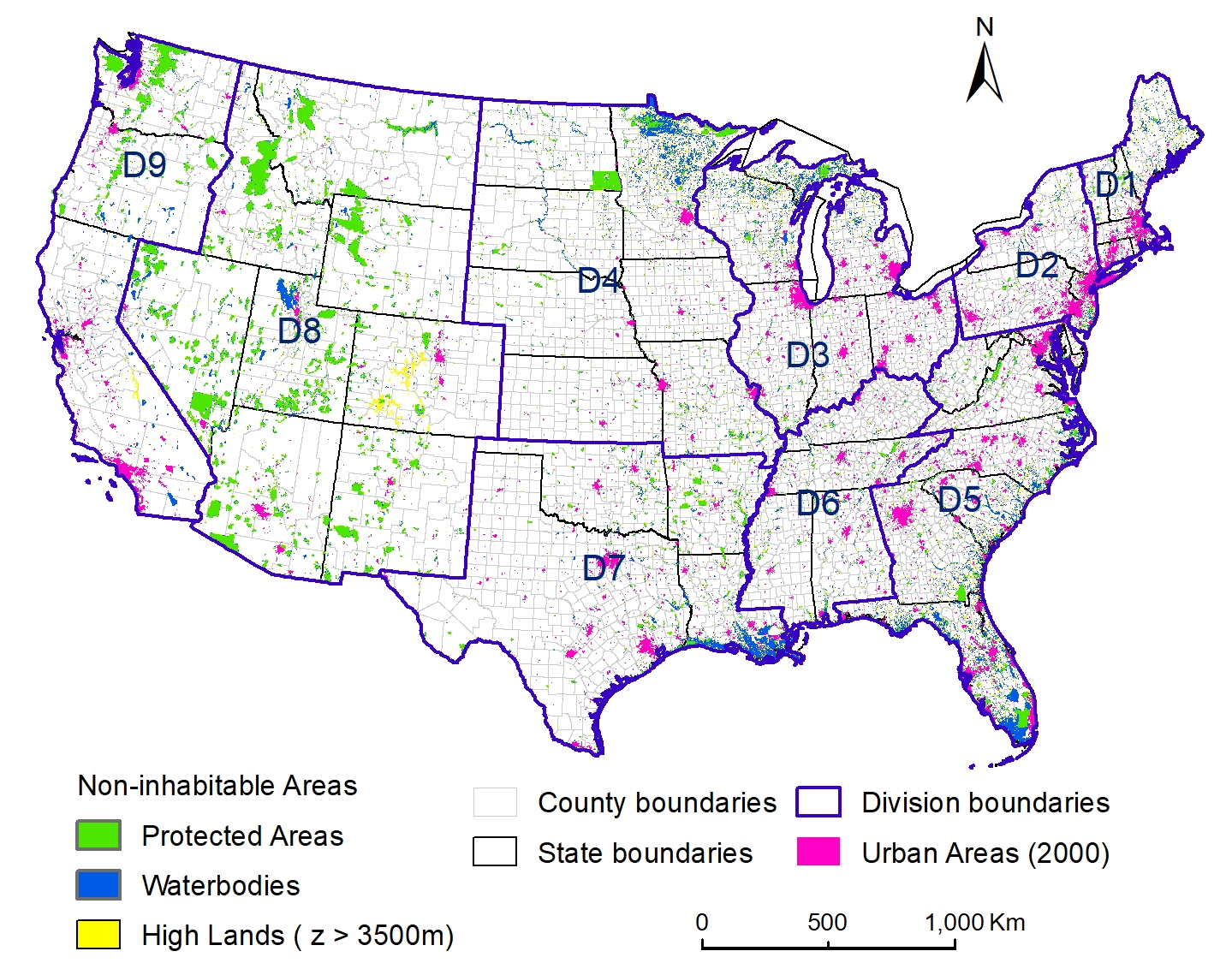
Where do people live, and how has this changed over timescales of centuries? Our group just published in Scientific Data (here) the first in our series of three papers analyzing these questions. In this work, we seek to understand human-environment interactions and their temporal dynamics by reconstructing the US population from 1790 to 2010 at 1-km2 resolution using five parsimonious landscape models of increasing complexity. The model spatial parameters were based on the following features of the landscape related to their ability to attract and support human populations: natural suitability, socioeconomic desirability, and inhabitability. The models were validated with census tract and county subdivision population data in 2000 and were applied to generate five sets of 22 historical population maps from 1790–2010. Overall, we found that separating urban and rural areas and excluding non-inhabitable areas were the most important factors for improving the overall accuracy. The paper reports on the model results, but also, importantly, serves as a data archive for interested users to download high-resolution GIS maps of the model results.

Population map generated by Model 5 for the conterminous US (a), census tract population (b), county subdivision population (c), and the five model outputs (M1 – M5) (d) in the South Atlantic region.
